LANDSketch for Highways

Product Description
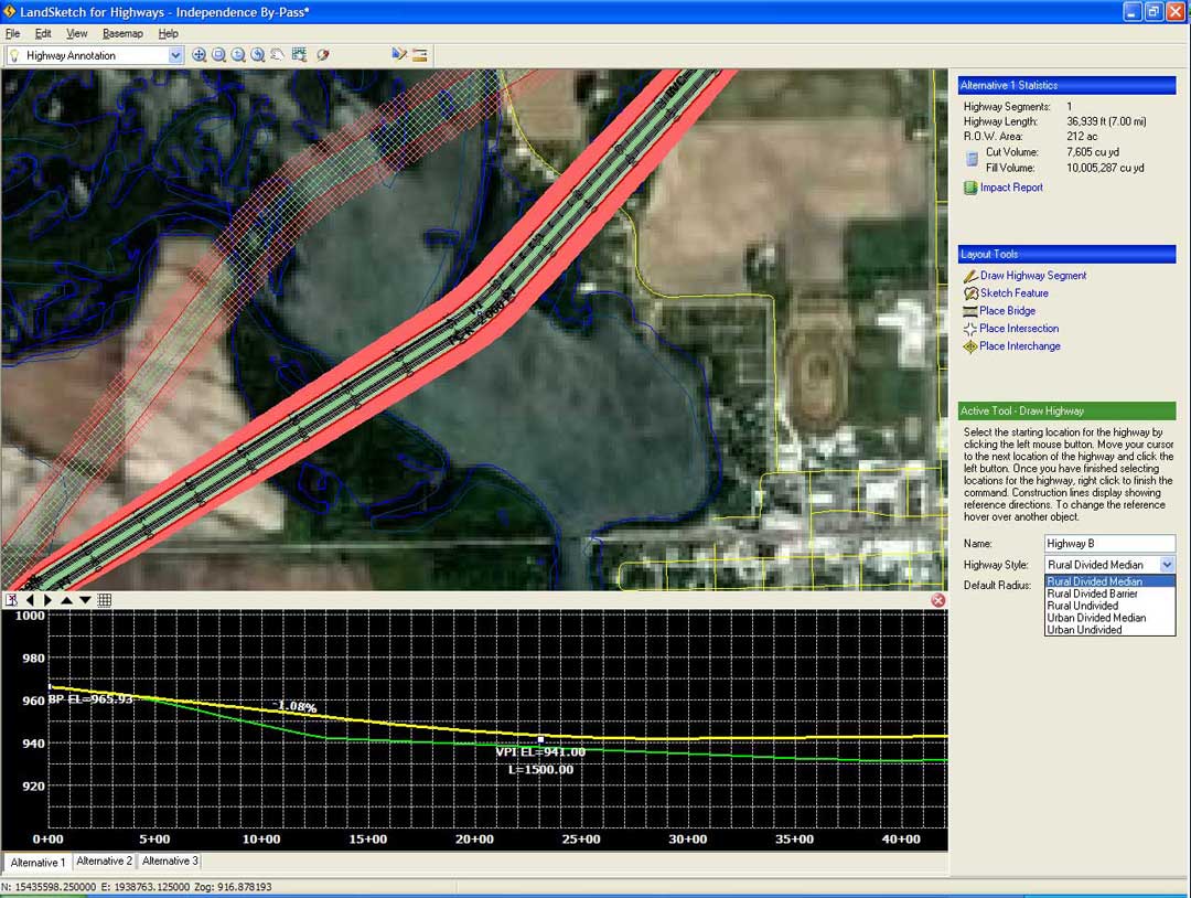
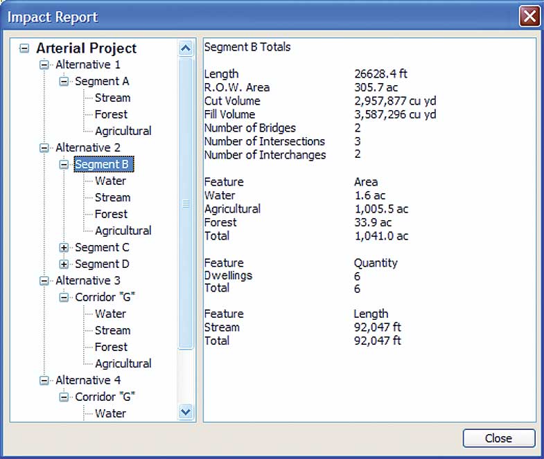
LandSketch for Highways contains just the right set of tools to perform preliminary design tasks for transportation planning. The ability to visualize and report on GIS environmental data is combined with powerful route layout tools to help analyze multiple corridor alternatives quickly. Back and forth iterations between engineering design CAD software packages and GIS are all but eliminated, allowing more time to be spent considering the most cost effective and least impactful alternative. When you're ready to create public display maps or move on to detailed design, your preferred alternative can easily be transferred via Shape (.SHP) and LandXML files.
Get the benefits of LANDSketch for Highways
- Eliminate steps in the repetitive GIS->CAD->GIS cycle with dynamic features
- Reduce costs by developing multiple alternatives quickly, utilizing the powerful route layout tools and dynamic editing capabilities
- Arrive at your preferred alternative sooner, easily visualizing conflicts and analyzing impacts while developing each route alignment
- Kick start the detailed design phase by transferring your preferred alternative data directly into your engineering design software
- Easily present alternatives live fostering better department collaboration and public interaction during planning and review meetings
LANDSketch for Highways Overview
Finding out more on...