Surveyors' Companion for Civil 3D

Product Description
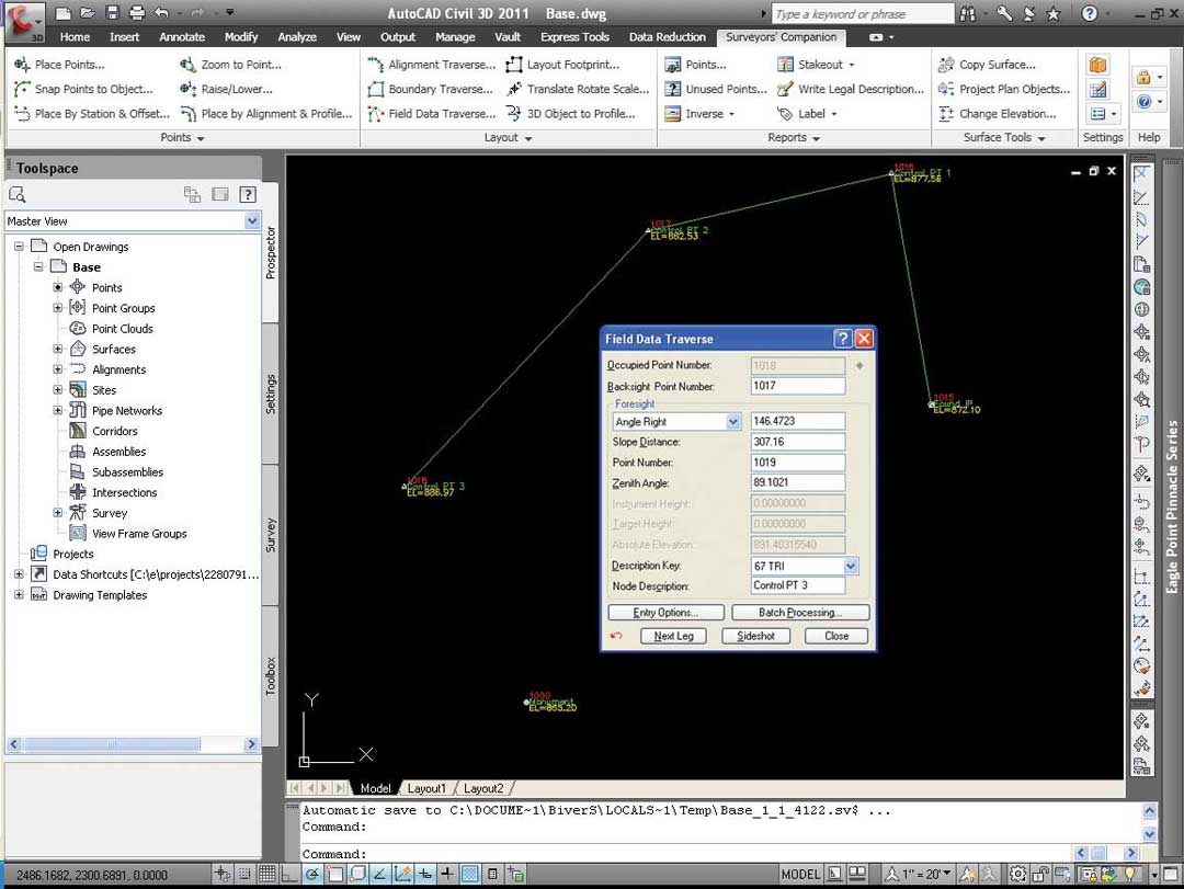
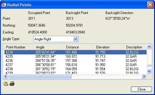
Surveyors' Companion allows you to comfortably and productively move to AutoCAD Civil 3D with simplified COGO routines and user interface. It's integrated within Civil 3D and interacts with native point, parcel, surface, alignment and profile data. Multiple routines (both dialog and command line based) are included to input raw alignment, lot and field traverse information directly into your drawings, bypassing the requirement of using an external survey database. Robust point placement routines are also available to quickly locate COGO points that can be uploaded to the field for staking.
Get the benefits of Surveyors' Companion for Civil 3D
- Straightforward commands cut through AutoCAD Civil 3D's sophisticated interface and provide simple surveying
- Intuitive interface and flexible options allow you to input and query survey information directly
- Input traverse information faster with efficient dialog box and command line interfaces
- Simplify staking point file creation
- Use streamlined reporting features to prepare, view and print legal descriptions, coordinate lists, stakeout reports inverse information and area reports.
Surveyors'Companion for Civil 3D Overview
Finding out more on...